
Property Search in Lucas County opens a gateway to parcel maps, ownership histories, and tax assessments without leaving your desk. By entering a parcel number, address, or owner name, you can instantly view deed documents, lot boundaries, and current market values. The online portal also flags exemptions and delinquency status, helping homeowners and investors verify records before a purchase or appeal. Seamless navigation and real‑time data keep your property decisions grounded in fact.
Property Search also supports deep dives into assessment trends, offering market, appraised, and assessed values side by side for every legal description. Users can pull property records by map, locate building footprints, and compare annual tax statements across years. When discrepancies appear, the system highlights unresolved parcels and guides you toward correction channels, ensuring your real‑estate research stays reliable and up‑to‑date.
How to Search Property Search
Property Search provides the public parcel record maintained by the Lucas County Auditor for identified real estate in Lucas County. A search helps readers locate ownership history accessible through official property owner guide records and situs and legal descriptions, assessment values, tax statements, exemptions, and related deed files Its main purpose is to let users check county-held property data against a parcel number, address, owner name, or legal description. Each result should be read with its parcel number and record dates in view.
Official Search Portal: https://www.lucascountyohioauditor.gov/areis
Steps to Search
- Open the official AREIS portal and locate its property-record search.
- Enter a supported identifier, such as a parcel number, street address, owner name, or legal description. Use the wording shown on a tax bill, deed, plat, or prior parcel record.
- Review the result list and compare the parcel number, situs address, owner name, and legal description before opening a record.
- Open the matching parcel to review ownership and deed history, classification, lot and building data, valuation, tax statements, payment status, and exemptions.
- Use the map or document options shown on the result when you need boundaries or recorded files. If a field conflicts with source documents, keep the parcel number and source reference for a correction request.
Parcel, Building & Ownership Details
The Lucas County Auditor’s parcel system links property records around a county parcel identifier. That identifier brings together the ownership, assessment, tax, and map entries for one assessment parcel. A sound match starts with the parcel number, legal description, and situs address rather than an owner surname alone.
Parcel number is usually the cleanest way to reopen a record after an initial search. An owner-name search can return several holdings, and a street address can cover more than one building or parcel. Confirm the legal description before reading a value, payment status, or transfer history.
Current Owner & Deed History
The current-owner field names the party carried in the Auditor’s parcel record. It is an assessment record and does not replace a title search. Title work can involve deeds, liens, easements, and court records that fall outside the ownership line shown for tax purposes.
Owner names may appear in a shortened form, and a parcel record can lag a completed transfer. For a purchase or other legal transaction, compare the current-owner field with the most recent deed entry and the closing documents. A change in the owner line alone does not explain every difference between the tax record and a title file.
Reading Transfer Entries
Transfer entries often pair a date with an instrument type and a document reference. A recorded sale may list the consideration or sale price, but not every transfer is an arm’s-length sale. The amount shown can reflect a gift, transfer between related parties, or another event that does not establish the property’s market value.
The recording date can differ from the closing date, and the two dates serve different purposes. A reference may use a volume and page, an instrument number, or a link to a recorded image. Use the date and instrument type to decide which transfer entry should be compared with the current owner field.
Property Classification & Situs Address
Property classification shows how the Auditor groups a parcel for assessment. Categories can include residential, commercial, industrial, agricultural, and exempt uses. The classification is an assessment category rather than a zoning decision, and it does not prove who currently occupies a building.
A property-type filter can help group results if the current search screen offers one. When no filter appears, use the classification after opening a matching parcel. A parcel marked as exempt still appears in the property system and should not be confused with a missing property file.
The situs address is the physical location of the property in the parcel record. It may differ from the address where tax papers are mailed. It can also lag a recent address correction, which makes it important to check the parcel number and legal description when an address has changed.
Matching an Address to a Parcel
Address matching starts with the street number, directional prefix, street name, and any unit designator shown on the source record. If one address returns several rows, compare the subdivision, owner, parcel number, and legal description. The address alone may cover a large parcel with multiple structures or a recorded subdivision.
A map search can help with rural addresses, recent road renames, or properties whose tax address differs from common search terms. After locating the parcel shape, open its parcel number in AREIS to confirm that the mapped land matches the legal description and owner record.
Lot Boundaries, Land & Structures
Land records describe the shape and size of the assessed parcel. Listed data may include acreage, lot area, dimensions, or subdivision references. These entries help a reader match the tax record with a plat, deed, or other source document that uses the same legal description.
Building footprints show the mapped outline of a structure rather than its condition. Building fields may include square footage, year built, stories, construction type, or other listed characteristics, depending on the parcel and source year. These fields support comparison across tax years, but they do not prove that a building meets a zoning, safety, or building-code requirement.
An online GIS map is not a property survey. A recorded plat, boundary survey, or other approved survey document carries greater weight for a boundary dispute. Use the map to identify the parcel, then compare the legal description and recorded documents before relying on a line, dimension, or building location.
Recorded Deed Documents & Files
Recorded deed documents and files connect the parcel’s transfer history to official recorded instruments. An entry may contain the instrument type, recording date, and a volume-and-page reference, instrument number, or document link. The transfer history tells a reader which document belongs with a reported ownership change.
Some AREIS entries open an official document viewer, while others display only index data. A deed image can show the legal description, parties, execution date, consideration, and recording stamp. The recording stamp confirms that the county accepted the document for recording, but it does not settle every question about title, property rights, or legal description.
An online search result or printout is not a certified copy unless it carries that designation. A party that needs certified evidence should request a certified copy through the official records process. Older documents can face legibility or file-retention limits, and a missing link may mean that the index lacks a linked image rather than that no deed was recorded.
Valuation & Tax Assessment
Assessment values in the Lucas County parcel record serve the property-tax process. They are not a real estate agent’s listing price, a mortgage appraisal, or a prediction of resale value. Each field has a different role, and the tax year or value date must be read with it.
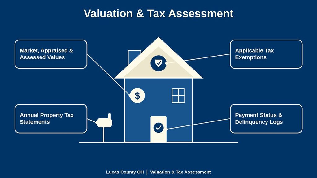
Market, Appraised & Assessed Values
Several value fields can appear together in an AREIS parcel result. Their labels are related, yet each one describes a different part of the assessment process.
- Market value: The Auditor’s estimate of the property’s value for assessment purposes. It does not represent a recent sale price unless the record specifically identifies the entry as a sale.
- Appraised value: The total appraised amount assigned after the land and improvements are considered.
- Assessed value: The portion of the appraised value used for real property tax. Ohio Revised Code Section 317.31 sets a 35 percent assessment ratio for real property, subject to statutory exceptions and limits on some assessed-value increases.
- Taxable value: The assessed amount remaining after applicable exemptions and other statutory adjustments. This figure connects the assessment record to the tax calculation.
These values are connected but should not be treated as interchangeable. A change can result from a county reassessment, new construction, a record correction, or a transfer-related valuation review. Check the value date and tax year before comparing one year with another.
Annual Property Tax Statements
An annual property tax statement, often called a tax duplicate, presents figures for a particular tax year. Depending on the year, the statement can show the parcel number accessible through official gis map records and owner, situs address, legal description, assessed and taxable values, exemptions, tax charges, and payment entries These lines connect the annual tax amount with the parcel record used to calculate it.
Prior-year statement options make it possible to compare values, exemptions, and charges for the same parcel. Keep the parcel number in view during that review, since values can change and some owner names can span more than one property. A change between years may reflect a reassessment or improvement instead of an incorrect earlier statement.
A tax statement is an annual snapshot. It shows what appeared on that statement and does not replace a current parcel search when checking present ownership or a later payment status. The Auditor supplies assessment data used in the tax process, while payment collection can involve other county offices.
Payment Status & Delinquency Logs
Payment status and delinquency logs connect a tax year or installment with the amount recorded as paid, unpaid, partial, due, or delinquent. The exact label can vary with the year and posting status. Read each entry with its tax year, installment number, amount, and posting date.
Do not treat an unpaid label as current without checking the related tax year. A historical balance can remain visible after a later year becomes the active period. Online posting can also follow a different schedule from the date a payment was made, which can create a short gap between receipt and screen display.
A delinquency entry records a collection status and does not act as a court judgment. If a receipt shows payment but the parcel record shows an unpaid balance, compare the receipt date, receipt number, tax year, installment, and amount with the displayed entry. The responsible tax-collection office can address a posting conflict after that comparison.
Applicable Tax Exemptions
Exemption entries show reductions or credits reflected in a parcel’s taxable value. Depending on the parcel and tax year, the record may show an exemption code, owner-related exemption, amount applied, or a line in the annual statement. The record confirms what Lucas County has entered; it does not contain the complete eligibility file.
An owner-occupancy, senior, disability, or other exemption can depend on facts such as ownership, use, age, disability status, and annual filing. A transfer, change in use, or change in ownership can affect whether an exemption continues. Compare the current year with the prior year rather than assuming that an exemption carries forward without review.
An exempt property classification is separate from an individual owner exemption. The first describes how the parcel is treated under its assessed use. The second shows a deduction or credit applied to a particular taxpayer and year. Keeping these records separate helps prevent a tax preference from being mistaken for missing property data.
Record Accuracy & Resolution
Record conflicts often arise from the gap between recording a deed, updating the assessment parcel, calculating the tax, and posting a payment. A completed sale can appear in a deed file before the parcel owner field changes. An address conflict can involve the physical situs and the owner’s mailing address. A missing result can reflect a search mismatch rather than a missing parcel.
Post-Sale Update Delays
Deeds pass through the county recording process, while the Auditor applies transfer details to the parcel and tax account. The two steps can occur on different schedules. Until both records align, an AREIS result may show an older owner, a newer transfer entry, or tax data from the prior year.
Compare the deed’s recording date with the transfer entry and current-owner field. The legal description should match across the documents, since a description error can prevent a clean match. If the transfer entry contains a recent instrument but the owner field has not changed, preserve the instrument reference and parcel number for an Auditor review.
No fixed delay should be assumed for every sale. Older transfers, recent subdivisions, corrections, and processing sequence can affect the display. The dates attached to the record offer a better basis for review than a general estimate of how long a transfer takes.
Resolving Parcel & Address Errors
Parcel number and legal description are the strongest anchors for a correction request. A street address can serve as a secondary check because one address may cover multiple buildings, and a situs address can differ from the owner’s mailing address. The legal description can also contain abbreviated street and subdivision names, so compare it with the recorded source rather than relying on spelling alone.
For an address correction, identify whether the error concerns the situs address, mailing address, subdivision spelling, or parcel assignment. A tax duplicate, deed, and recorded plat can each serve a different role in that review. The visual position of a parcel on a map can support the request but cannot replace the identifying fields.
For a name or ownership correction, use the deed or other recorded instrument that documents the change. State the exact field, the current entry, the correct entry, and the source document’s date. A clear correction request lets staff compare the same parcel without searching through unrelated holdings.
Unlisted Property File Resolution
A parcel that does not appear in the search may have an indexing problem, a parcel-number problem, or a file that has not yet been created in the searchable system. Begin with the parcel number from a tax bill or source document. If that fails, try the full legal description, then use the map and owner search with the complete recorded name.
Address variations can affect a result. A rural route, directional prefix, subdivision name, or multi-address property may be shown differently across the tax record, map, and deed. Comparing the legal description across those sources can identify which identifier should control the next search.
If a tax document names a parcel that the search does not return, keep the parcel number, legal description, situs address, and tax year together. The Auditor can check whether the parcel is present in the county system but omitted from the current result. Do not assume that an unlisted file means the land is absent, exempt, or without an owner.
Contact Details
Use these details for help with an AREIS parcel, ownership, valuation, assessment, or record-correction request. Provide the parcel identification number or property address when contacting the responsible office. Include a brief explanation of the information you need or the issue you found. For assessment disputes or ownership updates, ask about the required documents, deadlines, and applicable procedures.
Frequently Asked Questions
Property Search lets anyone view up‑to‑date parcel details for land in Lucas County. By entering an address, parcel number, or owner name, users can see ownership history, legal description, assessed value, tax information, and any exemptions. This tool helps buyers verify a seller’s claim, assists homeowners in checking their tax bill, and supports researchers looking for trends in local real estate. All data come straight from the Lucas County Auditor, ensuring accuracy and public access at no cost.
How can I run a property search by address in Lucas County?
Visit the AREAS online portal, type the full street address into the search bar, and click Search. The system returns the parcel number, owner name, legal description, and current assessment. Review the listed tax statements to confirm any outstanding balances. If the address does not appear, try variations such as adding “Unit” or removing “Apt.” For help, call the Auditor’s office at 419‑213‑4406.
What steps are needed to find a property owner by parcel number?
Locate the parcel number on a deed, tax bill, or map. Enter that number in the property search field on the Lucas County Auditor website. The result shows the owner’s name, mailing address, and ownership type. You can also view past owners by clicking the history tab. Print or save the page for records or to share with a real‑estate professional.
Can I search property records online for tax assessment details?
Yes. After entering an address or parcel number, select the “Assessment” tab on the result page. The page lists the current market value, land value, and any exemptions that lower the taxable amount. Compare the figures with the previous year to spot changes. If you notice a large jump, contact the Auditor’s office to request a review.
How do I locate a property using a legal description?
Copy the legal description from a deed or mortgage and paste it into the “Legal Description” search box on the AREIS site. The system matches the text to the correct parcel and displays the same details as an address search. This method works well for large parcels or historic properties that lack a standard street address.
What should I do if the property search shows no results?
First, double‑check the spelling of the address or the accuracy of the parcel number. Next, try a broader search such as the owner’s last name or the neighborhood name. If the record still does not appear, the property may be outside Lucas County or not yet entered into the database. Call the Auditor’s office for confirmation or to request a manual lookup.